
Natural wonder Australia and Oceania
Macquarie Island
Macquarie Island is a green island in the cold Southern Ocean. Millions of penguins and seabirds come there.
Macquarie Island lies in the Southern Ocean, about halfway between Australia and Antarctica. UNESCO says it is the only place on Earth where rocks from deep in the Earth's mantle are being pushed above sea level, and millions of seabirds and penguins come there.
Macquarie Island (34 km by 5 km) is the exposed crest of the undersea Macquarie Ridge, 1,500 km southeast of Tasmania, raised where the Indo-Australian and Pacific plates meet. A World Heritage site since 1997, it is, in UNESCO's words, the only place on Earth where mantle rocks are being actively exposed above sea level.
Photo: M. Murphy, public domain, via Wikimedia Commons
Discover Macquarie Island
Macquarie Island is far out in the Southern Ocean, between Australia and Antarctica.
In this photo, lots of penguins walk along a stony beach below green hills.
Macquarie Island is 34 kilometers long and 5 kilometers wide, about 1,500 kilometers southeast of Tasmania, Australia. Tasmania's park service says it is roughly halfway between Tasmania and Antarctica and feels the full force of the Southern Ocean.
This photo by M. Murphy looks over a beach on the island where royal and king penguins gather, with waves rolling in and steep green slopes behind.
UNESCO describes Macquarie Island (34 km long by 5 km wide) as an oceanic island in the Southern Ocean, 1,500 km southeast of Tasmania and about halfway between Australia and the Antarctic continent. The island and its waters out to 12 nautical miles were inscribed on the World Heritage List in 1997 for their natural values (Australian Antarctic Division).
The hero photo, by M. Murphy (public domain), is captioned on Commons as a view over a Macquarie Island beach with royal and king penguins.
- Size
- 34 km long, 5 km wide
- Location
- 1,500 km southeast of Tasmania, in the Southern Ocean
- World Heritage
- inscribed in 1997
Rocks from deep inside the Earth
Some of this island's rocks were once deep under the ocean floor.
The Earth's moving plates pushed them up.
Macquarie Island is the top of an undersea ridge, the Macquarie Ridge, pushed up where two of the Earth's plates meet: the Indo-Australian Plate and the Pacific Plate.
UNESCO says it is the only place on Earth where rocks from the mantle, normally 6 kilometers below the ocean floor, are being actively pushed above sea level. The island also has pillow basalts, lava rocks shaped like pillows.
According to UNESCO, the island is the exposed crest of the undersea Macquarie Ridge, raised to its present position where the Indo-Australian tectonic plate meets the Pacific plate. It is a site of major geoconservation significance: the only place on Earth where rocks from the mantle (6 km below the ocean floor) are being actively exposed above sea level.
These exposures include excellent examples of pillow basalts and other extrusive rocks, which UNESCO lists among the island's unique features.
Penguins, seals and seabirds
Millions of penguins and seabirds come to the island.
Elephant seals come to its beaches too.
Tasmania's park service says about 3.5 million seabirds and 80,000 elephant seals come to Macquarie Island each year to breed and molt. The Australian Antarctic Division says up to 4 million penguins are regular visitors.
The island lies close to the Antarctic Convergence, where nutrient-rich Southern Ocean water meets warmer water, making rich feeding grounds for penguins, seals and seabirds.
Tasmania Parks and Wildlife Service: around 3.5 million seabirds and 80,000 elephant seals arrive each year to breed and molt. The Australian Antarctic Division (AAD) counts up to 100,000 seals and 4 million penguins as regular visitors, and links the rich feeding grounds to the nearby Antarctic Convergence.
The AAD says rabbits, rats and mice, brought over nearly 200 years, were removed by 2014 after a 7-year project, and the island is returning to lush green. It also reports dieback in the endemic cushion plant Azorella macquariensis, which scientists in 2015 linked to drier, windier conditions caused by climate change.
Protecting the island
People work hard to keep the island's animals and plants safe.
Some beaches are closed at times so animals are not disturbed.
Macquarie Island is a Tasmanian nature reserve and a World Heritage site. Parts of the coast are closed at some times of the year to protect threatened wildlife.
To its south and east, the Macquarie Island Marine Park protects the ocean home of royal and southern rockhopper penguins, fur seals, elephant seals and five kinds of albatross.
The AAD notes the island and its waters to 3 nautical miles are a gazetted Tasmanian Nature Reserve, and access to many coastal areas is restricted at times to protect threatened wildlife, critical habitat, special ecosystems or historic places, with rangers advising expeditioners.
The Commonwealth Macquarie Island Marine Park, declared in 1999 (162,000 km² then, 475,465 km² now), protects habitat of threatened species such as the royal and southern rockhopper penguins, the subantarctic fur seal, the southern elephant seal and five albatross species.
Visiting safely
Penguins and seals often rest near people's buildings.
Visitors must keep away so they do not disturb them.
The Australian Antarctic Division says seals and penguins often rest beside the station's buildings, so people must take care not to disturb them. Tasmania's park service says the island is far enough south that few people can go there, and it takes the full force of the Southern Ocean.
The AAD asks that care be taken to minimize disturbance, since seals and penguins commonly rest in the shelter of station buildings, and rangers advise on restricted special management areas.
Tasmania Parks and Wildlife Service notes the island is far enough south that human access is limited, and that it is subject to the full force of the Southern Ocean.
Amazing facts
-
Some rocks on Macquarie Island once lay deep below the ocean floor!
Macquarie Island is the only place on Earth where rocks from the mantle, 6 kilometers below the ocean floor, are being pushed above sea level.
UNESCO calls Macquarie Island the only place on Earth where mantle rocks from 6 km below the ocean floor are being actively exposed above sea level.
-
Up to 4 million penguins visit Macquarie Island.
Up to 4 million penguins and 100,000 seals are regular visitors to Macquarie Island.
The Australian Antarctic Division counts up to 100,000 seals and 4 million penguins as regular visitors.
-
Seals and penguins like to rest next to the scientists' buildings!
Seals and penguins often rest in the shelter of the research station's buildings.
The AAD notes it is quite common for seals and penguins to rest in the shelter of station buildings.
Words to know
- mantle
- the thick layer of hot rock between the Earth's crust and its core
- subantarctic
- the cold region just north of Antarctica
- pillow basalt
- rounded, pillow-shaped lumps of lava rock that form when lava erupts under water
- molt
- to shed old feathers or fur so new ones can grow
- Antarctic Convergence
- the zone in the Southern Ocean where cold Antarctic water meets warmer water
Discovery challenge
-
Which ocean is Macquarie Island in?
In which ocean does Macquarie Island lie?
In which ocean does UNESCO place Macquarie Island, 1,500 km southeast of Tasmania?
- The Southern Ocean
- The Arctic Ocean
- The Indian Ocean
Show the answer
The Southern Ocean
The cold Southern Ocean.
The Southern Ocean, about halfway between Australia and Antarctica.
The Southern Ocean, about halfway between Australia and the Antarctic continent.
-
Where did some of the island's rocks come from?
What makes Macquarie Island's rocks special, according to UNESCO?
What does UNESCO say is being actively exposed above sea level only on Macquarie Island?
- Rocks from deep inside the Earth's mantle
- Rocks that fell from space
- Rocks carried by glaciers from Asia
Show the answer
Rocks from deep inside the Earth's mantle
From deep inside the Earth, under the ocean floor.
They come from the mantle, 6 kilometers below the ocean floor.
Mantle rocks from 6 km below the ocean floor.
-
Which animals come to Macquarie Island in huge numbers?
Which animals does the Australian Antarctic Division say visit in numbers up to 4 million?
Which birds does the AAD count at up to 4 million regular visitors?
- Penguins
- Camels
- Parrots
Show the answer
Penguins
Penguins.
Penguins, up to 4 million.
Penguins: up to 4 million, with up to 100,000 seals.
-
Which two plates meet near the island?
Where two plates meet, the Macquarie Ridge was pushed up. Which two plates?
Between which tectonic plates was the Macquarie Ridge raised to its present position?
- The Indo-Australian and Pacific plates
- The African and South American plates
- The Eurasian and North American plates
Show the answer
The Indo-Australian and Pacific plates
The Indo-Australian and Pacific plates.
-
What should visitors do when penguins and seals rest nearby?
What does the Australian Antarctic Division ask people to do around resting seals and penguins?
Why does the AAD ask expeditioners to take care near the station's buildings?
- Keep from disturbing them
- Feed them bread
- Pick them up
Show the answer
Keep from disturbing them
Leave them in peace.
Take care not to disturb them.
Seals and penguins often rest in the shelter of the buildings, so disturbance must be minimized.
Nearby places
-
 Watch
Natural wonder
Milford Sound / Piopiotahi
Milford Sound / Piopiotahi is a fiord in Fiordland National Park, in the south-west of New Zealand's South Island. Glaciers carved its steep valley, and the sea filled it. It stretches 16 kilometers to the open sea, and Mitre Peak rises 1,692 meters straight from the water. It is one of the wettest places in New Zealand.
-
 Watch
Natural wonder
Aoraki / Mount Cook
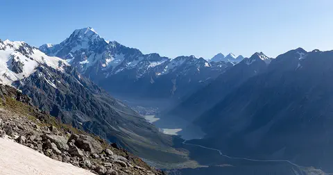
Aoraki / Mount Cook is New Zealand's highest mountain, in the Southern Alps of the South Island. Its name joins its Māori name, Aoraki, with its English name, Mount Cook. The mountain is being pushed up where two of Earth's plates meet, and glaciers carve the valleys around it. In 2013 surveyors measured it at 3,724 meters.
-
 Watch
Natural wonder
South Island
The South Island of New Zealand sits where two of Earth's tectonic plates meet. Their collision built the Southern Alps, which rise to nearly 4,000 meters close to the sea. Glaciers carved its fiords and lakes, and its southwest is a World Heritage area full of rare birds.
-
 Watch
Natural wonder
Southern Alps / Kā Tiritiri o te Moana
The Southern Alps / Kā Tiritiri o te Moana stretch hundreds of kilometers along New Zealand's South Island. Two of Earth's plates push together here, along the Alpine Fault, and NASA says the mountains should keep rising over time.
-
 Watch
City
Hobart
Hobart is the capital of Tasmania, the island state of Australia. It lies on the Derwent estuary, and kunanyi / Mount Wellington dominates its skyline. The City of Hobart calls it Australia's second-oldest city. About 233,736 people lived in the Hobart urban area in mid-2025.
-
 Watch
City
Christchurch
Christchurch is the main city of New Zealand's South Island. Universalis says English settlers founded it in 1850 on the wide Canterbury Plains, a few kilometers from the east coast. Its port, Lyttelton, lies beyond the Port Hills. About 407,800 people lived in the Christchurch urban area in mid-2025.
-
 Watch
Landmark
Te Papa
Te Papa, the Museum of New Zealand, opened on Cable Street in Wellington on 14 February 1998. Its name means 'container of treasures'. The building stands on soft land near a major fault line, so it sits on 152 base isolators that let it move gently in an earthquake.
-
 Watch
Natural wonder
Mount Ruapehu
Mount Ruapehu, at 2,797 meters, is the highest mountain in New Zealand's North Island and an active volcano. A crater lake fills its vent, and DOC says lahars, fast volcanic mudflows, are its main volcanic hazard.
Explore next
-
 Watch
Natural wonder
Southern Ocean
The Southern Ocean surrounds Antarctica; the United States defines it as the water from the coast out to 60 degrees south. It is the newest named ocean. A mighty current, the Antarctic Circumpolar Current, flows all the way around the planet here, and in spring and summer the sea fills with tiny algae and krill that feed penguins, seals and whales.
-
 Watch
Natural wonder
Antarctica
Antarctica is a continent at the bottom of the world, surrounded by ocean and covered by an ice sheet about 2 kilometers thick on average. Less than one percent of it is free of ice. It has no native population, but scientists work there, and countries have agreed to keep it for peace and science.
-
 Watch
Natural wonder
Galápagos Islands
The Galápagos Islands are a group of volcanic islands in the Pacific Ocean, about 1,000 kilometers off the coast of Ecuador. Many of their animals live nowhere else on Earth, and they helped inspire Charles Darwin's theory of evolution by natural selection.
-
 Watch
 Country
Australia
Australia is a country and the smallest continent, surrounded by ocean in the Southern Hemisphere. Much of its middle is dry and flat, most people live near the coast, and its animals include kangaroos, koalas and the platypus, a mammal that lays eggs.
- Watch Geography Layers of the Earth Earth is built in layers: a thin rocky crust, a thick mantle of hot rock, a liquid metal outer core and a solid metal inner core. Nobody has ever dug down to see them. Scientists learned about them from earthquake waves.
-
 Watch
Natural wonder
Île Saint-Paul
Île Saint-Paul is a small island of only about 8 square kilometers in the southern Indian Ocean. It is a young volcano whose crater collapsed and was flooded by the sea, and albatrosses nest on it.
-
 Watch
Natural wonder
Great Barrier Reef
The Great Barrier Reef stretches about 2,300 kilometers along the coast of Queensland, Australia. It is made of about 2,500 separate reefs and more than 900 islands, built by tiny coral animals, and it is home to more than 1,500 kinds of fish.
-
 Watch
Natural wonder
Uluru
Uluru is a huge sandstone rock in the desert of central Australia, rising 348 meters above the plain, with a base 9.4 kilometers around. The Anangu are its Traditional Owners, and the national park around it is run by Anangu and Parks Australia together.
For parents & teachers
What children will learn
- Locate Macquarie Island in the Southern Ocean between Tasmania and Antarctica.
- Explain how two meeting plates lifted rocks from the mantle above the sea.
- Name animals that breed or rest on Macquarie Island.
- Explain why visitors must not disturb wildlife.
Recommended ages: 3 to 17 · About 15 minutes
Talk about it
- Why might rocks from deep under the ocean floor be so useful to scientists?
- Why might so many animals breed near a place where cold and warmer water meet?
- Why might closing some beaches at certain times help animals?
Try at home or in class
- Cut an apple in half: if the thin skin is the Earth's crust, the fruit below is like the mantle, where Macquarie Island's deepest rocks came from.
- On a map, find Tasmania and Antarctica, then mark a point about halfway between them for Macquarie Island.
Key vocabulary: mantle, subantarctic, pillow basalt, molt, Antarctic Convergence
Where these facts come from
- Wikidata , Wikimedia Foundation (CC0 1.0)
- Macquarie Island , UNESCO World Heritage Centre
- Macquarie Island environment , Australian Antarctic Division
- Macquarie Island World Heritage Area , Tasmania Parks and Wildlife Service
- File:MacquarieIsland7.JPG , Wikimedia Commons
- UNESCO World Heritage List , UNESCO World Heritage Centre (Linked as a reference; site facts come from Wikidata)
- Natural Earth vector data , Natural Earth (NACIS) (Public domain)
- Wikimedia Commons , Wikimedia Foundation (Per file (public domain, CC0, CC BY or CC BY-SA); see each media record)
Checked, not yet human-reviewed. Last updated November 1, 2026. Spotted a mistake? Tell us.
Picture credits
- Photo: M. Murphy, public domain, via Wikimedia Commons · source