Landmark Asia
Angkor
Angkor is a giant old city in Cambodia. It has hundreds of stone temples hidden among the trees. Long ago, kings dug huge lakes and canals to bring water to the rice fields.
Angkor, in northwestern Cambodia, was the capital of the Khmer Empire from the 9th to the 15th century. Its kings built city after city here, with scores of temples, such as Angkor Wat and the Bayon, and giant reservoirs and canals to water the rice fields. Today it covers about 400 square kilometers, and more than 100,000 people live in villages inside it.
From the 890s, when Yashovarman I made it his residence, until its sack by Ayutthaya in 1431, Angkor was the seat of the Khmer kings. UNESCO's 400 km² World Heritage Site holds successive capitals, temples from Phnom Bakheng to the Bayon, and a vast hydraulic system; airborne lidar has since revealed the planned urban landscape around them.
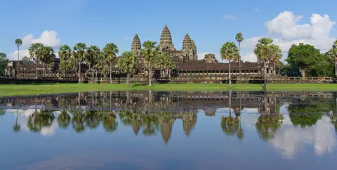
Photo: Satdeep Gill, CC BY-SA 4.0, via Wikimedia Commons
Discover Angkor
Angkor is in Cambodia, a country in Southeast Asia.
Long ago, it was the home of kings. They built lots and lots of stone temples. The most famous one is Angkor Wat. Today, trees, rice fields and villages fill the spaces between the temples.
Angkor lies just north of the town of Siem Reap, in northwestern Cambodia. For more than 500 years, from the 9th to the 15th century, it was the capital of the Khmer Empire, one of the largest and most prosperous kingdoms in Southeast Asia.
Angkor is not one building but a huge area of about 400 square kilometers. It holds scores of temples, such as Angkor Wat, the Bayon, Preah Khan and Ta Prohm, along with reservoirs, canals, dikes and old roads. The photo shows Angkor Wat, the most famous temple, which has its own page.
Angkor lies about 6 km north of Siem Reap. UNESCO describes it as one of the most important archaeological sites of Southeast Asia, about 400 km² of temples, hydraulic works (basins, dikes, reservoirs, canals) and routes, with several successive urban plans. Britannica calls it the royal center from which Khmer kings ruled, between the late 9th and early 13th centuries, a territory stretching from the tip of the Indochinese Peninsula to modern Yunnan and from Vietnam toward the Bay of Bengal.
UNESCO's criteria stress range and influence: the site spans the whole of Khmer art from the 9th to the 14th century, with masterpieces such as Angkor Wat, the Bayon and Banteay Srei, and Khmer art developed here shaped much of Southeast Asia. Angkor Wat, its most famous temple, has its own page.
- Where
- 6 km north of Siem Reap, northwestern Cambodia
- Khmer capital
- 9th to 15th century
- Size of the site
- about 400 km²
- World Heritage Site
- 1992
Five centuries of capitals
About 1,100 years ago, a king chose Angkor for his home.
Later kings built new temples and new city walls. One king built a great walled city. After hundreds of years, the kings moved away. Forest grew over many of the temples.
In the 890s, King Yashovarman I made Angkor his home and named his city Yashodharapura. Kings after him kept building, each adding new temples and changing the city. In the 1100s King Suryavarman II built Angkor Wat, and around 1200 King Jayavarman VII gave the walled city of Angkor Thom, the 'Great City', its final shape.
In the late 1200s, a visitor from China wrote that Angkor was still a huge, busy city. But the empire grew weaker. In 1431, armies from Ayutthaya, a kingdom in what is now Thailand, captured the city, and it was partly abandoned. By the 1500s, forest covered many of the temples.
Britannica dates Angkor's role as capital from the last decade of the 9th century, when Yashovarman I made it his residence and named it Yashodharapura, to the 15th. Successive rulers raised new central temples: the Phimeanakas of Suryavarman I (reigned about 1000 to 1050), the Baphuon of Udayadityavarman II (1050 to 1066), Angkor Wat under Suryavarman II (1113 to about 1150) and, around 1200, the Buddhist Bayon at the heart of Jayavarman VII's Angkor Thom. Religious life shifted over these centuries from Hindu cults to Mahayana Buddhism.
The Chinese envoy Zhou Daguan described a large, thriving metropolis in the late 13th century, but monumental building had ended, Theravada Buddhism was rising and Ayutthaya's armies pressed on the Khmer heartland. After they sacked Angkor in 1431, the city was partly abandoned; by the 16th century, Britannica says, only jungle-covered temples and ruined waterworks remained.
A city built on water
The kings of Angkor were very good with water.
Workers dug giant square lakes and long canals. Water ran around the temples in wide ditches called moats. The water helped farmers grow lots of rice.
One of Angkor's greatest achievements is its water system. Workers built huge rectangular reservoirs, called barays, along with canals, dikes and moats around the temples. Britannica says they were mainly for controlling water and watering the rice fields.
UNESCO says most of the barays and canals still exist today. The first king's city was built around a temple on Phnom Bakheng, the only natural hill in the area. Later kings built their central temples as stone pyramids instead.
Britannica describes Angkor's reservoirs, canals and moats as one of its most notable features, serving primarily for water control and rice irrigation. UNESCO notes that most of the barays and canals survive.
The early city was laid out around Phnom Bakheng, the one natural hill in the area, completed as a temple. Later central temples, such as the Phimeanakas, the Baphuon and the Bayon, were entirely built pyramids. UNESCO adds that Khmer architecture grew from that of the Indian subcontinent but soon developed its own character, and that the layout of the successive capitals reflects a highly ordered, ranked society.
Temples everywhere
Angkor has many, many temples.
Some are huge and some are small. One temple stands on a hill. One sits in the middle of a big walled city. Some are made of brick and some of stone.
Each king of Angkor wanted his own great temples, so the site is full of them. Phnom Bakheng stands on the only natural hill. The Bayon was built in the middle of Angkor Thom, the walled 'Great City'. Preah Khan, Ta Prohm and Banteay Srei are other famous temples.
The temples were built for the Hindu religion and, later, for Buddhism. They are made of brick and stone, and UNESCO calls several of them, including Angkor Wat, the Bayon and Banteay Srei, masterpieces. Building styles changed over the centuries as kings came and went.
UNESCO counts scores of temples and singles out Angkor Wat, the Bayon, Preah Khan and Ta Prohm as exemplars of Khmer architecture, and Angkor Wat, the Bayon and Banteay Srei as artistic masterpieces. Britannica identifies the central temples of successive capitals, from the hill temple of Phnom Bakheng to the Buddhist Bayon at the center of Angkor Thom.
UNESCO stresses that all that survives of the Khmer civilization is its heritage of religious buildings in brick and stone. Britannica traces repeated changes in architecture and artistic style, alongside religious change from Hindu traditions to Mahayana Buddhism, with Theravada Buddhism rising by the late 13th century. UNESCO's local tradition notes also record that the Preah Khan temple is considered to have been a university of medicine.
- Famous temples
- Angkor Wat, the Bayon, Preah Khan, Ta Prohm, Banteay Srei
- Angkor Thom
- built about 1200 by Jayavarman VII
- Art from
- the 9th to the 14th century

A living site
People still live at Angkor today.
They live in villages and grow rice. Visitors come from all over the world to see the temples. Experts work hard to keep the temples safe.
Angkor is not empty ruins. More than 100,000 people live in 112 old villages inside the park, and many of them grow rice, as people here did long ago. Local people also weave cloth and baskets and make sugar from palm trees.
Repair work at Angkor began in 1907, and since 1993 many countries have helped Cambodia look after it. Cambodia's APSARA National Authority, set up in 1995, manages the site. Visitors are welcome, but UNESCO warns that too much tourism and building can damage it.
UNESCO describes Angkor as an inhabited site: more than 100,000 people in 112 historic settlements, some families tracing their ancestry to the Angkor period, mostly growing rice. That brings pressure on the property, from villages seeking to expand and from the growth of Siem Reap as a tourism hub.
Conservation began in 1907, carried out by the Ecole Francaise d'Extreme-Orient and later the Archaeological Survey of India, Poland's PKZ and the World Monuments Fund, among others. Since 1993 the ICC-Angkor has coordinated the international projects, and since 1995 the APSARA National Authority has managed the park. Angkor was inscribed in 1992 and placed on the List of World Heritage in Danger, from which it was removed in 2004. UNESCO notes that tourism brings great economic potential but can also cause irreparable damage.
Amazing facts
-
The first king's city was built around a temple on a hill.
The first capital at Angkor was built around a temple on Phnom Bakheng, the only natural hill in the area.
Yashovarman I's city centered on Phnom Bakheng, the one natural hill in the area, completed as a temple.
-
A visitor from China wrote about Angkor long ago.
In the late 1200s, a visitor from China named Zhou Daguan described Angkor as a large, busy city.
The Chinese envoy Zhou Daguan described Angkor in the late 13th century as a large, thriving metropolis.
-
Lasers helped scientists find a hidden city.
Laser scanning from the air revealed a whole planned city hidden under the forest at Angkor.
Lidar revealed a previously undocumented, formally planned urban landscape into which temples such as Angkor Wat were integrated.
-
More than 100,000 people live at Angkor today.
More than 100,000 people live in 112 old villages inside the Angkor site, and many grow rice.
Angkor is inhabited: more than 100,000 people live in 112 historic settlements across the property.
Words to know
- Khmer
- the people and language of Cambodia, and the empire they built
- baray
- a huge rectangular reservoir built at Angkor to store water
- reservoir
- a big lake, often made by people, for storing water
- irrigation
- bringing water to fields so crops can grow
- lidar
- a way of mapping the ground with laser pulses, often from an aircraft
- capital
- the city where a country's or empire's rulers are based
Discovery challenge
-
Which country is Angkor in?
In which country is Angkor?
In which modern country's northwest does Angkor lie?
- Thailand
- Cambodia
- Vietnam
Show the answer
Cambodia
Cambodia! It is in Southeast Asia.
Angkor is in northwestern Cambodia, just north of the town of Siem Reap.
Cambodia: Angkor lies about 6 km north of Siem Reap, in the northwest.
-
What did Angkor's big lakes and canals help to grow?
What were Angkor's reservoirs and canals mainly used for?
According to Britannica, what was the main purpose of Angkor's reservoirs, canals and moats?
- Watering rice fields
- Boat races for kings
- Keeping crocodiles
Show the answer
Watering rice fields
Rice! The water helped farmers grow lots of rice.
They controlled water and carried it to the rice fields that fed the city.
Britannica says they served primarily for water control and rice irrigation.
-
How did scientists see the ground under the trees?
What did scientists use to map the ground under Angkor's forest?
Which technology revealed Angkor's planned urban landscape beneath the canopy in 2013?
- X-ray glasses
- Lasers from an aircraft
- Deep-sea divers
Show the answer
Lasers from an aircraft
Lasers! A special laser flew over the forest.
Lidar sends laser pulses from an aircraft down through gaps in the leaves to measure the ground.
Airborne laser scanning (lidar), which produced high-precision models of the ground surface.
-
Which temple is in the middle of the Great City, Angkor Thom?
Which temple stands at the center of Angkor Thom, the 'Great City'?
Which Buddhist temple was the central temple of Jayavarman VII's Angkor Thom?
- Banteay Srei
- Angkor Wat
- The Bayon
Show the answer
The Bayon
The Bayon! It is in the middle of the walled city.
The Bayon was built at the center of Angkor Thom by King Jayavarman VII, around 1200.
The Bayon, central temple of the city to which Jayavarman VII gave its final form.
Nearby places
-
Watch
Landmark
Angkor Wat
Angkor Wat, near the town of Siem Reap in Cambodia, was built in the 12th century by the Khmer king Suryavarman II. Britannica (2026) calls it the world's largest religious structure. It was built as a Hindu temple and later became a Buddhist place of worship.
-
 Watch
City
Bangkok
Bangkok, the capital of Thailand, lies on the delta of the Chao Phraya River, about 40 kilometers from the sea. It became the capital in 1782, when the new royal palace and temples were built. Once called the 'Venice of the East' for its canals, it is now a huge, busy city with skyscrapers and an elevated railway.
-
 Watch
City
Ho Chi Minh City
Ho Chi Minh City, once called Saigon, is Vietnam's largest city and the economic heart of the country. It lies on the Saigon River, north of the Mekong Delta. Since merging with two neighboring provinces in 2025, it has more than 14 million people, and in 2024 it opened its first metro line.
-
 Watch
Natural wonder
Son Doong Cave
Son Doong is a cave in the mountains of central Vietnam, inside Phong Nha–Ke Bang National Park. A river carved it, and its main passage is so wide and tall that a whole city block of skyscrapers could fit inside. Explorers first went in only in 2009. UNESCO says it holds the world's largest documented cave passage.
-
 Watch
Natural wonder
Phong Nha–Ke Bang National Park
Phong Nha–Ke Bang National Park, in central Vietnam near the border with Laos, protects one of the world's great limestone landscapes. UNESCO says its rocks began forming about 400 million years ago, and more than 220 kilometers of caves and underground rivers have been mapped. One of them, Son Doong, holds the world's largest known cave passage.
-
 Watch
Natural wonder
Ha Long Bay
Ha Long Bay is a bay in northeast Vietnam where more than a thousand limestone islands rise straight out of the sea. Over millions of years, water dissolved the limestone into towers and caves, and then the sea flooded in around them. Together with the nearby Cat Ba Archipelago it is a World Heritage site.
-
 Watch
Landmark
Petronas Towers
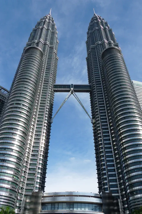
The Petronas Twin Towers in Kuala Lumpur, Malaysia, are two matching skyscrapers 452 meters tall, finished in 1998. Seen from above, each floor is shaped like an eight-pointed star, a pattern from Islamic art. A two-story skybridge joins them 170 meters above the ground, and from 1996 to 2003 they were counted as the tallest buildings in the world.
-
 Watch
City
Hong Kong
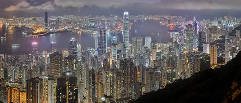
Hong Kong, on the south coast of China, grew around one of the world's great natural harbors. It was a British colony for 156 years and has been a special administrative region of China since 1997. About 7.5 million people lived there in mid-2026.
Explore next
-
 Watch
 Country
Cambodia
Cambodia is a country in mainland Southeast Asia, a land of wide plains and great rivers. Its Tonle Sap lake more than doubles in size every rainy season, and Angkor, with the remains of capitals built from the 800s to the 1400s, is one of the most important archaeological sites in Southeast Asia.
-
Watch
Landmark
Angkor Wat
Angkor Wat, near the town of Siem Reap in Cambodia, was built in the 12th century by the Khmer king Suryavarman II. Britannica (2026) calls it the world's largest religious structure. It was built as a Hindu temple and later became a Buddhist place of worship.
-
 Watch
Landmark
Borobudur
Borobudur is a huge Buddhist monument in central Java, Indonesia, built about 1,200 years ago. It is shaped like a stepped pyramid around a small hill, with carved walls and 72 bell-shaped stupas on its round top terraces. For centuries it lay hidden under volcanic ash and plants, and today it is a UNESCO World Heritage Site.
- Watch Geography What is a World Heritage Site? World Heritage Sites are places so important that they belong, in a way, to everyone. Under a 1972 agreement, countries nominate their most outstanding places, experts check them, and a UNESCO committee decides. By 2026 the list held 1,273 sites: cultural places like the Taj Mahal, natural places like the Galápagos, and mixed ones like Machu Picchu.
-
 Watch
Landmark
Agra Fort
Agra Fort is a huge red sandstone fortress beside the Yamuna River in Agra, India. The Mughal emperor Akbar began it in 1565. Its walls, about 2.5 kilometers around, protect palaces, halls and mosques added by later emperors. It was both an army base and a royal home.
-
 Watch
Landmark
Al-Aqsa Mosque
Al-Aqsa Mosque stands at the southern end of a huge raised plaza in the Old City of Jerusalem. Built in the early 700s, it has a silver-gray dome, and the golden Dome of the Rock stands nearby. The plaza is important to Muslims and to Jews.
-
 Watch
Landmark
Al-Masjid al-Haram
Al-Masjid al-Haram, the Great Mosque of Mecca in Saudi Arabia, was built around the Kaaba, a cube-shaped building that Muslims face when they pray. It is the most important place of pilgrimage in Islam. In 2026, 1,707,301 pilgrims came to Mecca for the hajj, and the mosque can hold up to about one million worshippers.
-
 Watch
Landmark
Anuradhapura
Anuradhapura, in north-central Sri Lanka, was the island's capital for more than 1,000 years. Its ruins include huge bell-shaped brick monuments called dagobas, monasteries, palaces and ancient reservoirs. It is an important place for Buddhists, and a World Heritage Site since 1982.
For parents & teachers
What children will learn
- Locate Angkor in Cambodia and explain that it was the Khmer capital from the 9th to the 15th century.
- Explain how reservoirs and canals helped Angkor grow rice for a large population.
- Describe how lidar lets archaeologists map ground hidden under forest.
- Recognize that Angkor is a living site where many people still live and farm.
Recommended ages: 3 to 17 · About 15 minutes
Talk about it
- Each king of Angkor built new temples. Why might a new ruler want buildings of his own?
- Angkor's water system helped it grow, but some researchers think it also played a part in its decline. How could something so useful become a problem?
- More than 100,000 people live inside the Angkor site. How can a place be protected and still be a home?
Try at home or in class
- In a sand tray or baking pan of soil, dig a 'baray' and channels from it, then pour water in and watch how the canals carry it to your 'fields'.
- Cover a few small toys with a sheet of paper and press gently: talk about how the shapes show through, like lidar finding the shape of the ground under trees.
Key vocabulary: Khmer, baray, reservoir, irrigation, lidar, capital
Where these facts come from
- Wikidata , Wikimedia Foundation (CC0 1.0)
- Angkor , UNESCO World Heritage Centre
- Angkor , Encyclopaedia Britannica
- Uncovering archaeological landscapes at Angkor using lidar (Evans et al., PNAS 2013), abstract , PubMed, US National Library of Medicine
- UNESCO World Heritage List , UNESCO World Heritage Centre (Linked as a reference; site facts come from Wikidata)
- Wikimedia Commons , Wikimedia Foundation (Per file (public domain, CC0, CC BY or CC BY-SA); see each media record)
Checked, not yet human-reviewed. Last updated October 27, 2026. Spotted a mistake? Tell us.